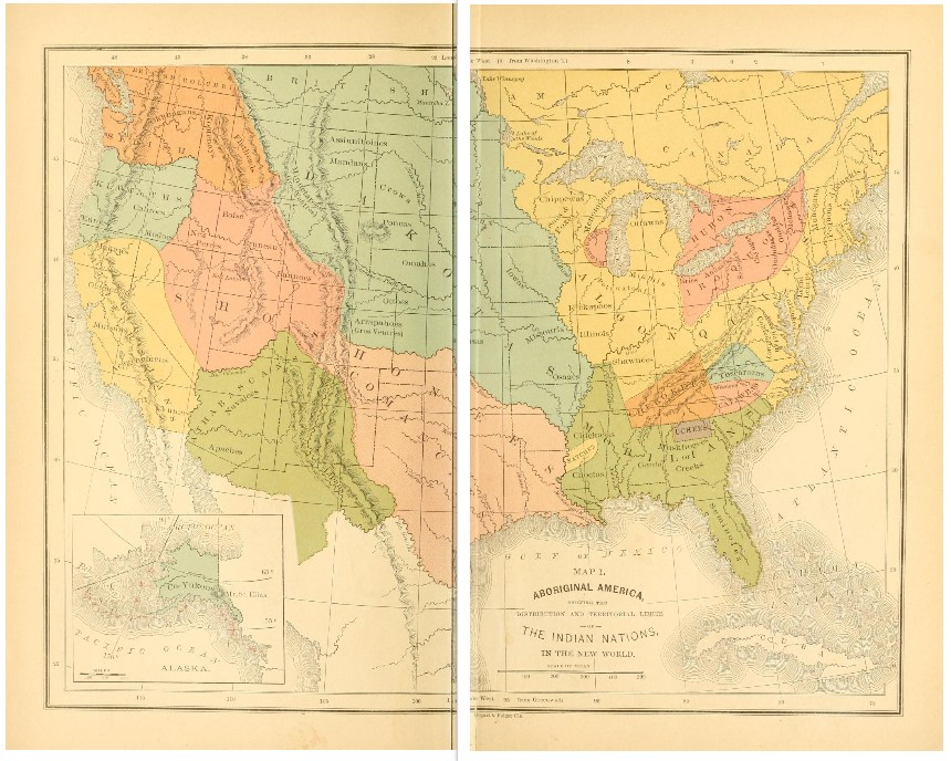
1882 map of Aboriginal Nations
Source: Ridpath, John C. A popular history of the United States. Phillips & Hunt. New York. 1882.
I started looking into the history of the Shoshoni in Texas about 10 months ago. I had Ridpaths’ book downloaded on my kindle app for a few years before I noticed it for the first time. Outside of my family history, I never heard of such a connection for the Shoshoni in Texas, so this was a big help for me as a visual aid. So, in this post, I’ll just post a few maps and some names the Shoshoni have been called according to the sources I currently have.
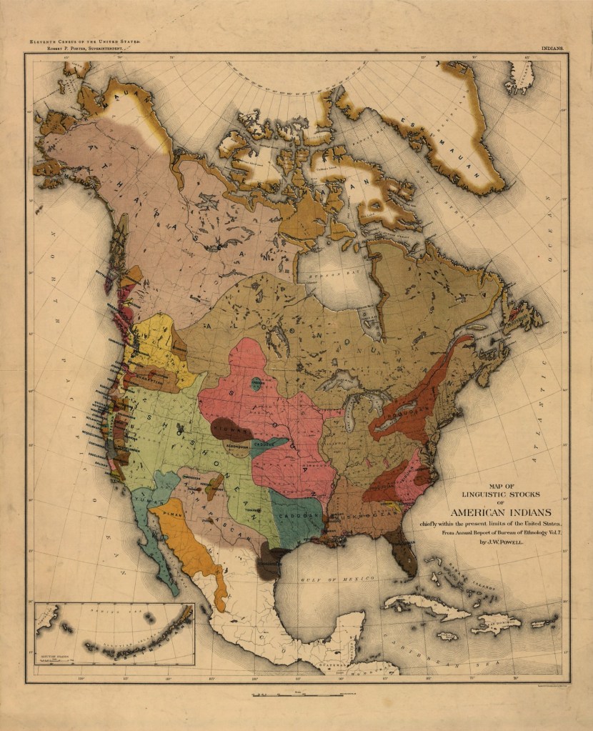
Ridpath used this map in an updated 1906 version of the 1882 text. This map is arranged by linguistic stock instead of the noting the lands inhabited by the various North American Indian nations/tribes. Note the location of the Shoshoni speaking family and the inclusion or update of the Caddoan speaking family now shown in the eastern Texas portion. The map was made by J.W. Powell for the Bureau of Ethnology for the 11th United States census of 1890.
2 things to keep in mind about the Shoshoni and North American Indians in general. 1. They didn’t disappear and 2. Most nations have several different names which they are known by.
pg 477 of Brownell’s book
Source: Brownell, C. De Wolf. The Indian races of north and south America. pg 477. Boston. 1853.
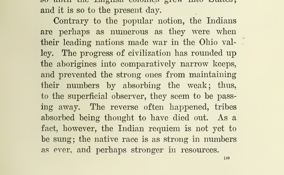
The Indians were not disappearing
Source: Ridpath, J.C. The new complete history of the United States. Vol. 1, pg 149. Cincinatti. 1905.
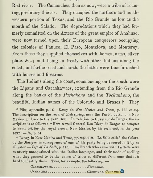
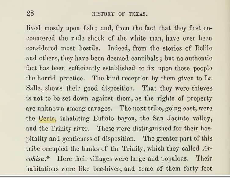
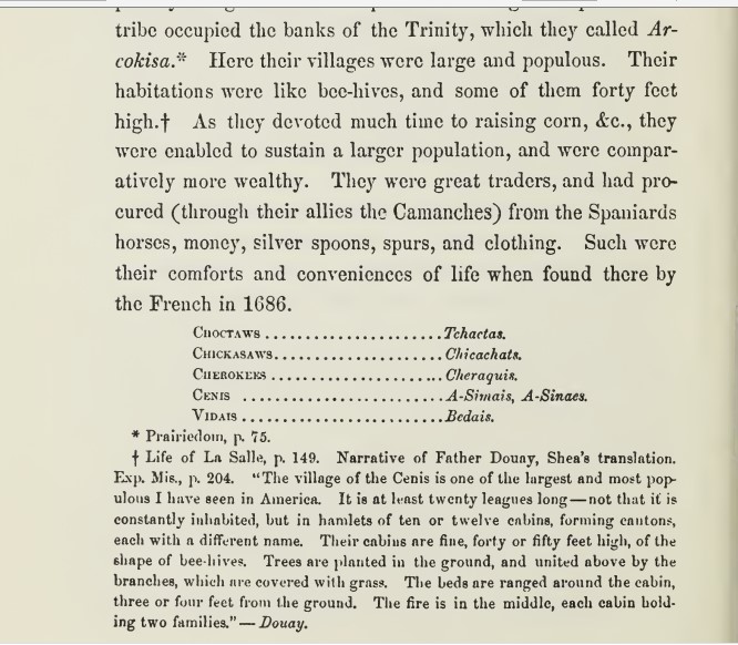
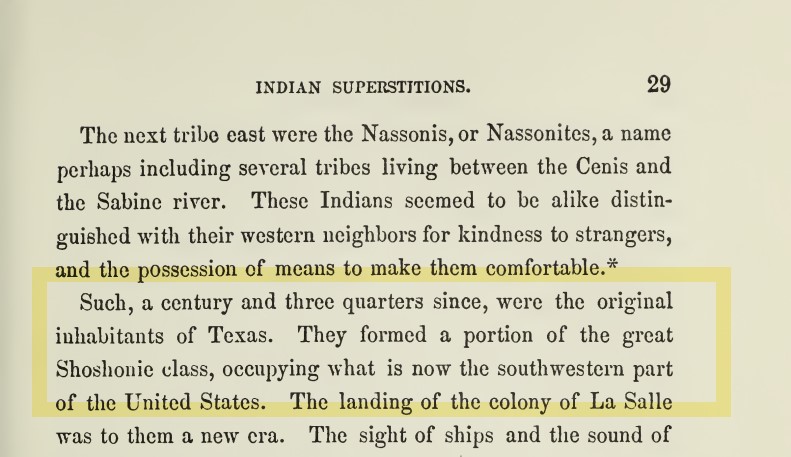
Source: Yoakum, H. History of Texas. Vol 1. pgs 27-29. New York. 1855.
Yoakum names the Comanches, Lipans, Karankawas, Cenis, and Nassonis as aborginal inhabitants of Texas and claims they are apart of the great Shoshonie class of Indians. So, although I don’t agree with some of the things Yoakum says about the Shoshoni, I do see a pattern for pre-1885 texts referring to the extent of land from the Columbia river in the modern northwest USA and how thru linguistic classification or disclassification, eastern Texas Shoshoni were classified either with the Caddo Indians or another neighboring/allied tribe, like the Comanche. But from the first map shown, the Shoshoni inhabited a large portion of the Cental and Southwestern lands of the modern United States of America.
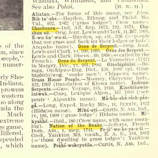
Some names of the Shoshoni
Source: Handbook of American Indians, North of Mexico. Editor: Hodge, Frederick W. Part 2. pg. 565. 1907. Washington, Government Printing Office.
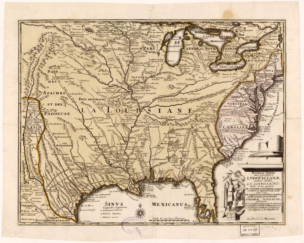
Map of Louisiana and the course of the Mississippi. William d’Isle. 1718.
The Shoshoni were called various names by their friends and enemies. The fransciscan jesuit military priests called them “Gens du Serpents,” so I wanted to show what the renown French mapmaker, William d’Isle placed on the above map in 1718. Along the modern day Louisiana/Texas coast, he notes the “Cap du Nord” (North Cape) and the “Pointe aux Serpens” (Snake point). In the map above, d’Isle lists the same tribes as Yoakum, the Cenis, the Nassonis, the Choumans or Comanches, but by their French language equivalents of the time.
In my next post, I’ll discuss/display the some interesting finds on the Shoshoni (Chochones) in relation to New Spain, New Grenada, Mexico and colonization in general.
Thanks for stopping by, peace out!!

Leave a comment